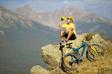
Steamboat Springs is truly a mountain biking haven. Trails are abundant in both the Routt National Forest and Steamboat Ski Area. Spectacular scenery accompanies all of the trails and courses, with destinations such as hot springs, creek side picnic spots and forested camping sites.
Mountain bike rentals are available at various ski & sport shops around town. The tour providers offer rentals and guided mountain bike trips as well. Most of the Steamboat Springs mountain bike trail systems are well maintained, creating world-class biking that attracts visitors from around the country.
Check out these local mountain biking tour providers along with popular trails in the area.
Take the Buffalo Pass Road, #60 to Summit Lake. Turn right on Road 310 and follow approximately two miles to trail 1101. Park in the parking area and begin biking along the Continental Divide to junction 1102. Turn right onto 1102 to Long Lake. At Long Lake follow the service road to Fish Creek Reservoir. Return to starting point on Road 310. Roundtrip distance: 14 miles. Rating: Easy.
Stagecoach State Park: Trail begins at fishing access parking lot off Routt County Road 16 at south end of Stagecoach Reservoir. At about 4.5 mi., trail crosses the dam and joins Routt County Road 18. Follow Routt County Road 18 to park road, past marina and offices. Take right on Routt County Road 14 and back to Routt County Road 18. Roundtrip distance: 10 miles. Rating: Easy. Description: Wildlife viewing.
Access trail at corner of Amethyst Drive and Maple St. Follow Routt County Road 34 (single-lane, rough road) 1/2 mi. to reservoirs. Trail continues approximately 4 mi. to Dry Lake Campground. Roundtrip distance: 8 miles. Rating: Easy/Moderate.. Description: Within Steamboat Springs city limits.
Take Routt County Rd. 129 to Routt County Rd. 64 and continue east for about 4 mi, to NFSR 429 on left. Take Coulton Creek Trail #1188 about 5 mi. north to Cutover Trail #1188A. Follow trail #1188A east for about 1 mi. to Scott Run Trail #1177. Take trail #1177 south for 1 mi. to NFSR 430, then follow this road south about 2 mi. to Routt County Rd. 64 about 2 mi. west back to trailhead #1188. Roundtrip distance: 13 miles. Rating: Moderate/Difficult. Description: mostly single track.
Take US 40 southeast to Dumont Lake NFSR 315 to NFSR 311. Take 311 north about 4 mi. to Wyoming Trail #1101 at Basecamp Trailhead. (NOTE: 4WD suggested on NFSR 311). Follow Trail #1101 north about 3 mi., past Fishhook and Lost Lake to Lake Elmo. Return to Basecamp Trailhead. Trail # 1101 continues north to the Wyoming state line. Roundtrip distance: 6 miles. Rating: Moderate. Description: Excellent fishing.
This is a paved, in town, four-mile, multi-use recreation trail which runs along the meandering Yampa River. There are several access points from West Lincoln Park, along U.S. 40, throughout downtown, and East to Walton Creek Road. Roundtrip distance: 8 miles. Rating: Easy. Description: several easy fishing access points, picnic areas, and botanical gardens.